Earth Surface
Many geomorphic and environmental projects are centered around one basic question: How is the earth’s surface changing? Two common ways to address this question are historical, measuring change over time, and modeling, attempting to predict future change based on current conditions and knowledge. The ability to capture upwards of 10,000 points per square meter with centimeter scale accuracy means laser scanning can provide data that supports both of these approaches at an unprecedented level of detail.
The predictive power of any quantitative model is strongly influenced by the quality of its inputs. Although a 10 m DEM may be fine for modeling basin scale runoff it is completely inadequate for modeling hillslope scale overland flow. Ground-based laser scanning can easily produce DEMs with cells 0.10 m or smaller, making modeling at this scale feasible. Individual stumps and bunches of grass divert flow paths, while flow realisticly accumulates in existing rills. Because dense vegetation severely restricts the ability to image the underlying ground surface these applications are best suited to semi-arid and drier environments. Nonetheless, laser scanning provides an opportunity to explore geomorphic process at previously inaccessible scales.
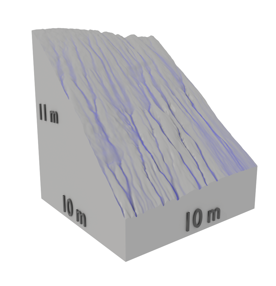
Simulated flow over a 4 cm DEM.
In addition to its superior spatial resolution laser scanning can often increase the temporal resolution of monitoring campaigns. With simpler deployment logistics and on-site requirements compared to mobile or airborne systems, sites can be reoccupied more often while remaining cost effective. Increasing the temporal resolution of any monitoring time series has clear advantages in dynamic environments where important events might otherwise be missed. For small sites the study area can be reimaged as often as multiple times per minute, providing near real-time monitoring capabilities.
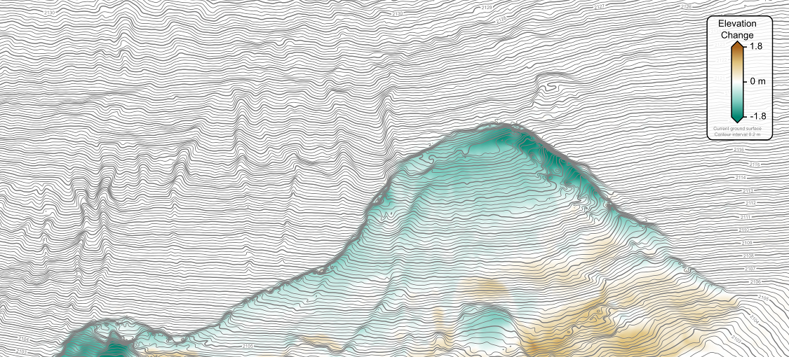
The difference in surface elevation after a medium size slump.
Although many geomorphic and environmental projects are well suited to straightforward and well-tested GIS based analytical approaches, the truly 3D surface models that can be produced using laser scanning open the door to more novel applications. From characterizing facies distributions in sedimentary outcrops to measuring the geometric properties of fractures exposed in the floors, walls, and ceiling of tunnels and mine shafts, laser scanning provides a tool that can bring new levels of understanding to old problems.
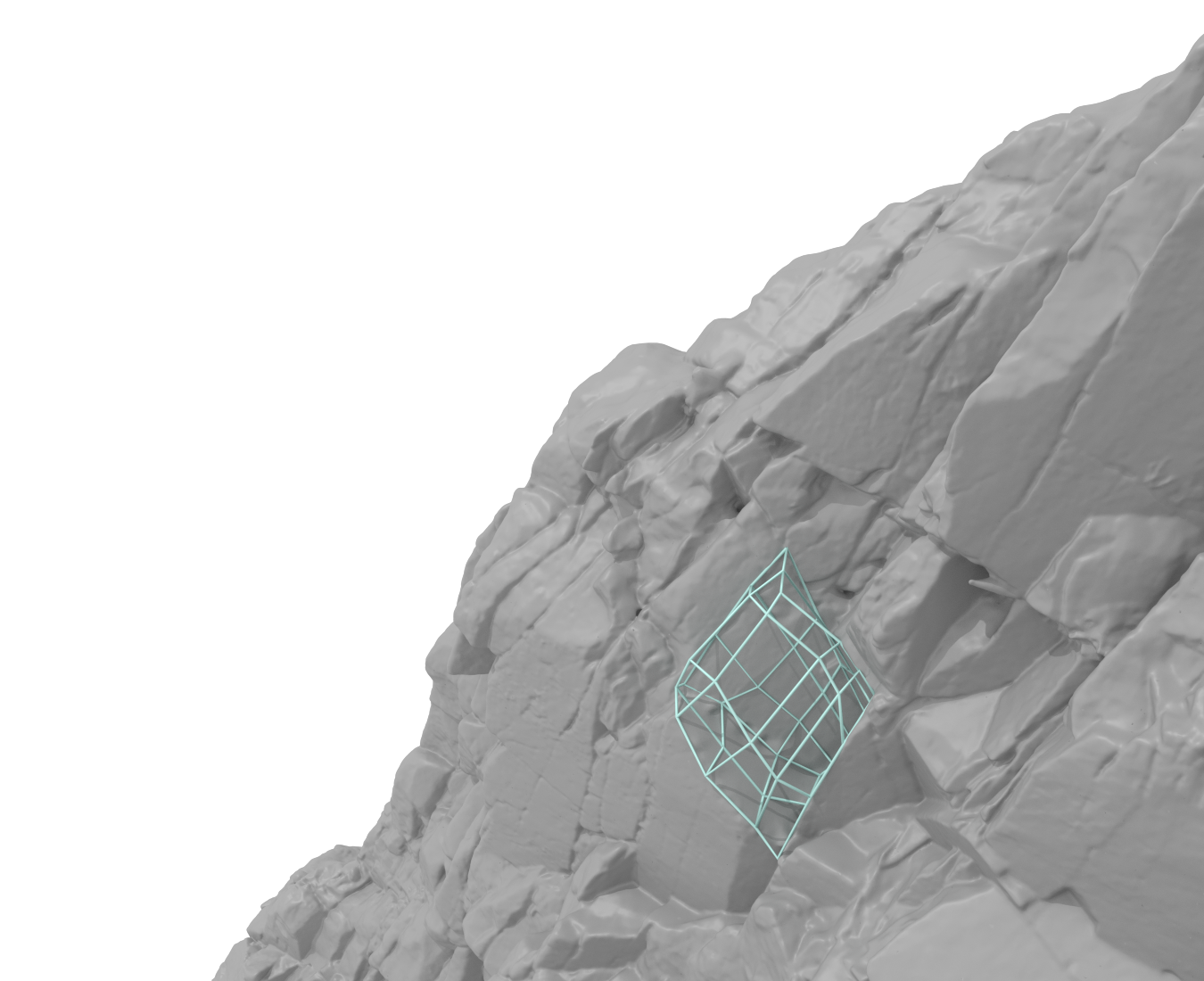
Measured rockfall volume of 0.56 cubic meters.