Golf
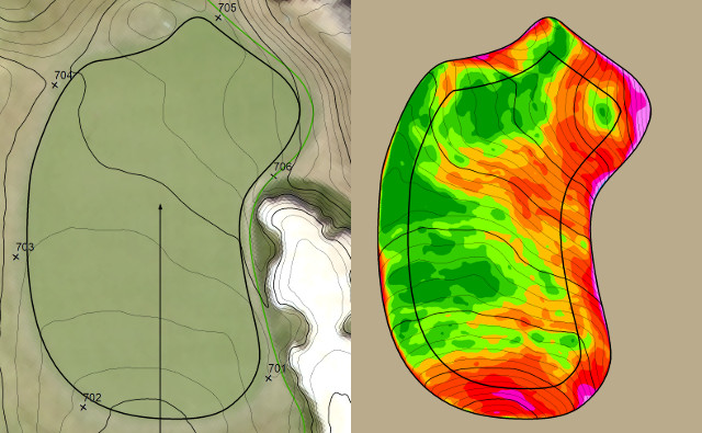
Since 2013 Lidar Guys has partnered with Point North Land Surveying and Mapping to provide 3D golf course services. Our primary client is ezLocator, who relies on our scan data to produce green slope maps for their pin placement system.
We are also pleased to offer a full suite of mapping and data collection services for others in the golf industry. We can scan and model existing green and bunker complexes to provide 0.1 foot resolution elevation models. When greens inevitably need to be renovated these as-built models offer the ability to return them to their exact pre-construction configuration after repairing structural or performance problems. Alternatively, these detailed 3D models can be used to completely redesign greens, providing architects with invaluable reference data so that they can get their design right the first time.
We also provide mapping of course infrastructure using a combination of airphoto analysis and GPS data collection. By consolidating infrastructure documentation in a central geospatial database long-term maintenance and monitoring can be greatly simplified.